Characterization of algal-invertebrate mats at offshore platforms and the assessment of methods for artificial substrata studies
Abstract
From the Summary: “The composition of biofouling communities on three offshore platforms in the Gulf of Mexico was examined. A platform in South Timbalier block 54 lay in 22 m of water 40 km from shore. A platform in Grand Isle block 94 lay in 60 m of water 86 km offshore. A platform in Green Canyon lease block 18 lay in 219 m at 150 km offshore near the edge of the continental shelf. The three platforms had been the site of previous fisheries-related investigations and offered an offshore gradient. Research operations were carried out from the platforms with Exxon and Mobil corporations hosting and providing logistical support. Field sampling was initiated in November 1995, and completed September 1997.
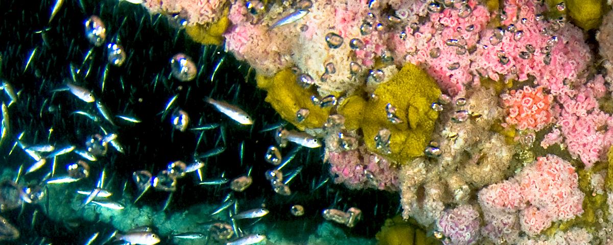
Video surveying, high-resolution photography, surface scraping, and settling plates were employed to describe the biota and to evaluate the effectiveness of the methods. Combined, the methods showed that the inshore ST-54 platform biota conformed to a previously recognized inshore type dominated by barnacles with overgrowths of algae and hydroids. The more seaward platforms conformed to a previously recognized offshore type dominated by a mix of bivalves and larger barnacles overgrown by sponges, hydroids, and ectoprocts (bryozoans). No evidence could be found of a bluewater assemblage. Settling plates showed that new crust was forming at a slower rate at the most offshore platform, GC-18.
A scenario was developed which viewed the biofouling crust as a system in equilibrium between accretionary growth and crust shedding. Loss of crust is a direct consequence of the vertical orientation of platform benthos and is an important factor distinguishing platforms from natural systems. Accretion of the crust is dependent on the passing ocean water for food and new larval settlement. Biotic interactions such as predation, competition, and bioerosion all contribute to crust loss directly or in concert with wave surge. The ecological scenario of an equilibrium system helps identify high priority research questions.
Of the methods applied, all provided data and some degree of understanding. Video survey, however, proved a poor tool for obtaining quantitative data on species composition, but was very useful for planning and site characterization. The higher resolution of photography was better for quantitative data, the complexity of layered assemblages escaped documentation. Scrape samples were most informative but lacked consistent quantification. Settling plates produced important rate information, but the demands on dive time proved unrealistic given constraints of weather and conflicting platform operation.”